Skip to main content Skip to page footer

Geographic Information System (GIS)

GIS, or Geographic information systems, are computer-based tools used to store, visualize, analyze, and interpret geographic data. GIS connects data to a map, integrates location data providing a foundation for mapping and analysis. Varous data modelling tools like SLEUTH were used to generate prediction of city growth. The data is processed, analysed, calibrated and validated to obtain visualization of future land use scenarios. 

GIS Solutions & Technology

Open Street Maps (OSM), & Leaflet JavaScript library

OpenStreetMap provides data about roads, trails, cafés, railway stations, etc. We have built multiple projects using OpenStreetMap. Leaflet is the leading open-source JavaScript library for interactive maps. Leaflet along with other plugins was used to add advanced GIS features.

SLEUTH: a C language Linux application

SLEUTH was used to generate various prediction models of Indian cities for a given year. It has Urban Growth Model (UGM) and Land cover deltatron model (LCD) generation functionalities. The term 'SLEUTH' is derived from initiials of Slope, Land cover, Exclusion, Urbanization, Transportation, and Hillshade.

NodeJS App

We created a NodeJs application to integrate SLEUTH with TYPO3. SLEUTH, a C application program runs on a separate Linux server. A user logs into TYPO3 site and makes requests to generate GIS models. Request tokens are verified. And after the model is generated by SLEUTH, the model files are made available to the TYPO3 user to view and download.

3D Map & geospatial applications

Enable organizations to visualize and analyze 3D geospatial data. Businesses can create interactive maps and dynamic visualizations that enhance decision-making processes. Urban planning, environmental monitoring, real-time asset tracking applications are few examples

GIS related files

Various file types and bundles of files (datasets) were used. Some to show boundary, some shown as layers on the map

  • .shp, .shx 
  • .geojson files
  • .cpg, .dbf, .prj, .sbn, .sbx


QGIS, Grass-GIS

Multiple third party tools like QGIS, Grass-GIS, etc were used to build an optimized web application online. We manage to keep the server costs down using alternative methods, keeping the number of servers to minimal. The website is  generating land use maps, DEM’s, built up maps, slope, hillshade, road maps.

GIS Specialist for hire:

Our GIS Developers can program, design, and develop GIS software applications. Contact us with your requirement.
Write to us at info@t3in.com and explore how we can assit you.

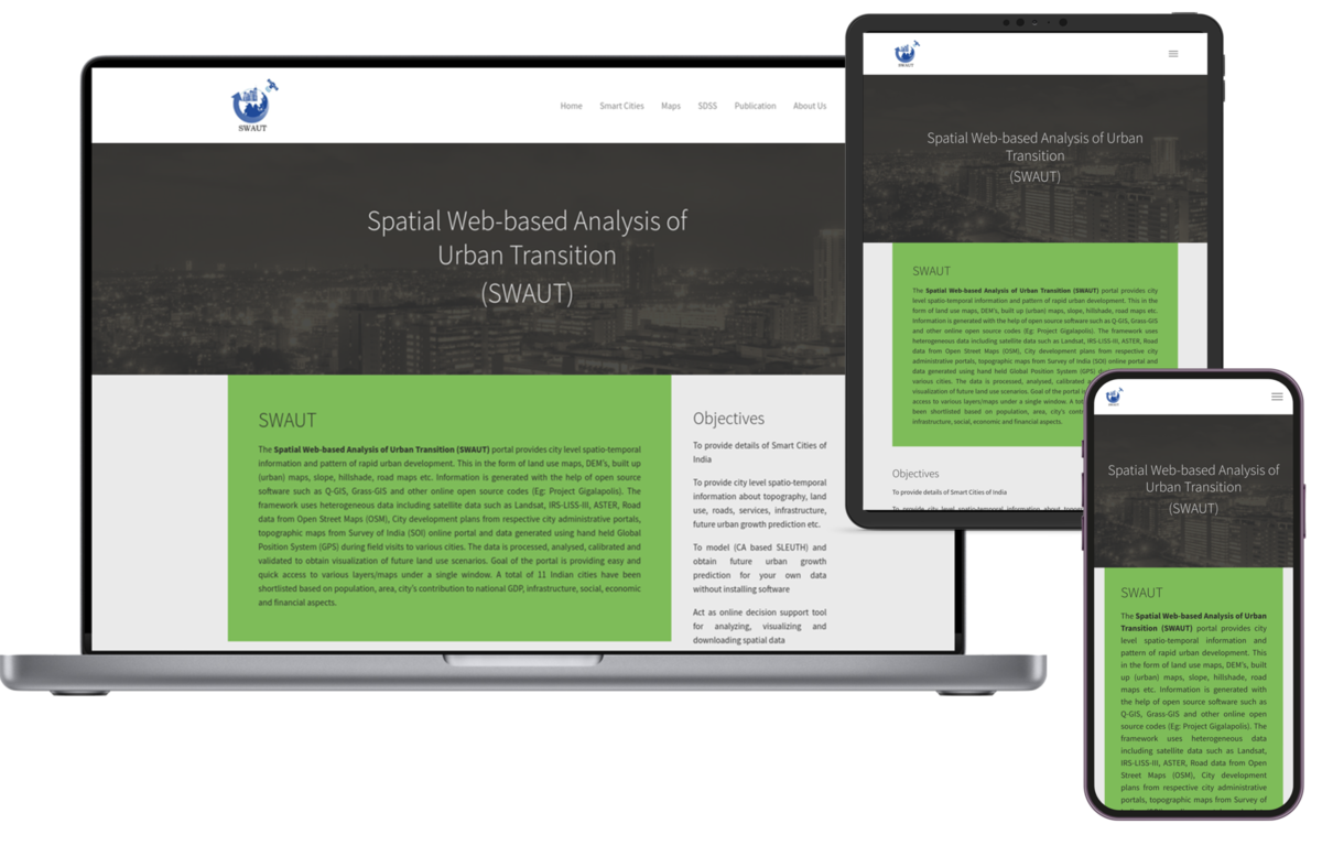
Project: Spatial Web-based Analysis of Urban Transition (SWAUT)

Geo-spatial solutions for a better India.

SWAUT website was created under guidance of Dr. Bharat (Head, Energy and Urban Research Group - EURG, Professor at RCGSIDM, Indian Institute of Technology Kharagpur) with active participation of  Dr. Chandan M C. (Research Scholar at RCGSIDM, IIT-Kharagpur. Master’s degree in Remote Sensing and GIS from National Institute of Technology) and many other scholars from the field of GIS system, data mining and urban growth modeling.

Development of GIS Features and functionality

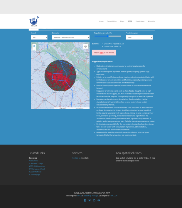
Spatial decision support system (SDSS)

A spatial decision support system (SDSS) is a computer-based tool for assisting a human decision-maker. It assists and analyzes data and presents processed information in a human friendly form to the decision-maker. 

We have created services for users to generate predictive SDSS models based on data uploaded by users. The system comprises multiple variables and input parameters to generate models.

The process of generation of models takes a fair amount of time. The system could take anywhere from 10 mins to 30 mins to generate a model. And in addition to that the user’s request is placed in a queue along with others. After generation of the model the user is informed via email with a link to download the model.  The models are stored in the server for 36 hours. Hence a user is required to download the generated model within the time frame.

Feedback

Dr. Chandan M C, Research Scholar at RCGSIDM, Indian Institute of Technology, Kharagpur. Master’s degree in Remote Sensing and GIS from National Institute of Technology, Karnataka. His areas of interests are geo-informatics, urban infrastructure, web mapping, web based processing, data mining and urban growth modeling:

Five reasons for five stars.
1. Excellent service.
2. Technologically updated and sound.
3. Responding time-less than 24 hrs.
4. Prompt and transparent.
5.  Reliable and efficient.